The Next Evolution In Industrial Technology: Get a free instant online quote or contact us for more information

Robust dual positioning performance in the most challenging environments with all satellite constellations as standard - GPS, GLONASS, Beidou and Gallileo. No hidden upgrade fees.
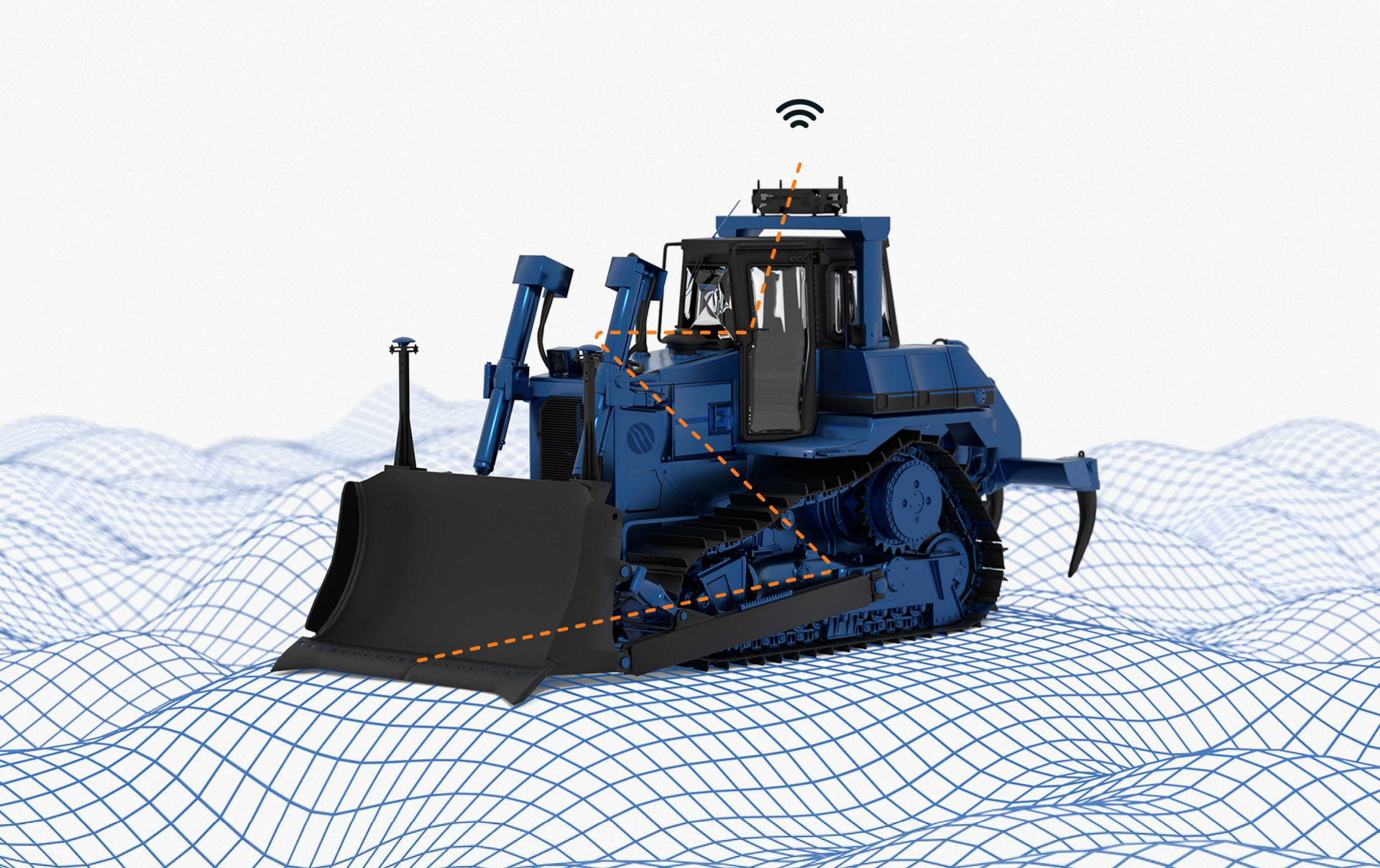
The dozer system uses a highly ruggedised antenna designed for the increased vibration experienced by dozers.


Direct mount antennas on the blade (masted) or have antennas on the roof (mastless). The Primary antenna gives the machine its 3D position and the Secondary antenna allows a heading to be calculated instantaneously as the machine turns regardless of direction of travel.

Our fast-tracking sensors continuously keep you updated and accurately informed about your digging progress. The sensors detect pitch and roll of the chassis, push arms and blade. Slopes and depth are updated continuously, resulting in fast and precise cycle times.

Get accurate cut/fill values regardless of blade pitch, roll or heading. Support for both conventional blade and 6-way blade systems.
Robust dual positioning performance in the most challenging environments with all satellite constellations as standard - GPS, GLONASS, Beidou and Gallileo. No hidden upgrade fees.
The dozer system uses a highly ruggedised antenna designed for the increased vibration experienced by dozers.


Direct mount antennas on the blade (masted) or have antennas on the roof (mastless). The Primary antenna gives the machine its 3D position and the Secondary antenna allows a heading to be calculated instantaneously as the machine turns regardless of direction of travel.

Our fast-tracking sensors continuously keep you updated and accurately informed about your digging progress. The sensors detect pitch and roll of the chassis, push arms and blade. Slopes and depth are updated continuously, resulting in fast and precise cycle times.

Get accurate cut/fill values regardless of blade pitch, roll or heading. Support for both conventional blade and 6-way blade systems.
RaptorTech gives you the best machine control on the market, but we don’t charge like the big guys. No fluff, no fancy markups—just solid tech at a price that makes sense.
Want proof? Use our price calculator and see what your setup would actually cost. No guesswork. No surprises. Just the price you should’ve been paying all along!
Unicontrol is compatible with all the industry standard design files and correction formats.
Base station RTK corrections:
UHF – Most construction sites run RTCMv3.2 – a universal correction format that all hardware vendors support. While a small number of sites will run a proprietary correction format (e.g. CMR X) we will always work with site surveyors to enable the additional format if required.
NPTRIP – We are fully compatible with any NTRIP (internet) correction stream
File formats:
Unicontrol accepts DXF design / linework files as well as land XML files. These are industry standard and can be exported from any of the design packages that surveyors use.
In rare cases where surveyors are only able to provide a proprietary file type, our support engineers will do the format conversion for you and upload the new design directly to your machine through the Unicloud.
Unicontrol has redesigned this product from the ground up with the latest technology. This means you’re not paying for the last 20 years of development mistakes. Each component was carefully selected to build a cost effective solution without compromising on quality.
Our hardware is world class – USA manufactured with 2 years warranty – and the Samsung rugged display beats anything else on the market for readability and touch sensitivity.
Oh – and we just make a bit less margin that our competitors. We believe everyone in the industry should be able to access this technology, not just those with fat wallets!
Short answer – No. While an internet connection does give you some really useful features (like remote file upload and support) you can work completely offline while receiving RTK corrections over UHF. All files can be uploaded via USB directly onto the tablet.
A cool feature with our wireless tablet is that you can take it somewhere with Wi-Fi over lunch and the screen will automatically download files as soon as it has an internet connection. Several of our mining customers working on remote sites use this feature to avoid the hassle of surveyors going to each machine
Important point to remember – to get NTRIP corrections, you will need an internet connection. All it takes is a sim card with a data plan.
RaptorTech is an authorised reseller for the HxGN Smartnet NTRIP service. There are base stations located across the country and chances are there is one near you – so if you don’t want to buy a base station but still need high-precision GPS, let us know and we can get you a quote!
We can also help you setup your own UHF or NTRIP base station networks if you are running multiple machines which can save you in the long term.
No- RaptorTech can supply the hardware and support you in setting up a base station that works over UHF, Internet (NTRIP) or both which is a particularly powerful option. Several of our customers have increased their value proposition by not only supplying a machine to a job but also providing the base station for the site for all the machines operating there.
RaptorTech also offers innovative solar enclosures to allow you to setup your base in a remote location and never worry about charging a battery every night.
Currently Unicontrol only offers a blade mount (masted) solution. We are actively working on a roof mount (mastless) solution which will add tilt sensors to the push arms as well as the blade to calculate blade position.
Yes – we support 6-way blades with our blade mounted system. This means that we have 2 antenna masts and a tilt sensor giving direct blade measurement.